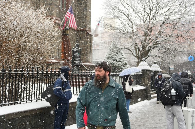
Temperatures near or below zero degrees Fahrenheit are set to grip the eastern third of the country this week, with wind chill making it feel as cold as minus 50 in some areas.
The National Weather Service warned early Wednesday that a “dangerously cold Arctic air front” would bring single-digit or subzero temperatures to the northern Plains on Thursday and into the mid-Mississippi Valley, the Ohio Valley and the Northeast by Sunday.
And more severe weather is on the way: This cold air mass is set to interact with a frontal zone to the South, generating a “major winter storm” that will impact a huge area from Texas to the East Coast from Friday and through the weekend.
From Wednesday, strong gusty winds will lead to dangerous wind chills, prompting extreme cold warnings and watches for the northern Plains and the Upper Midwest beginning Wednesday night.
Frostbite and hypothermia can occur even in calm, windless conditions, according to the weather service.
Snow and icy conditions in the Northeast are already causing havoc, with multiple reports of road accidents. Interstate 90 in New York was closed westbound Tuesday night due to multiple crashes, New York State Police said.
The fire department in Fredonia, New York, shared images on social media of a pileup involving 60 vehicles on I-90 that stretched more than 6 miles.
The Great Lakes region is also set to receive between 6 and 12 inches of lake-effect snow through Friday, with up to 2 feet due in areas downwind of Lake Ontario. Winter storm warnings are in place downwind of Lake Michigan and Lake Ontario.
Parts of upstate New York across I-81 toward the Tug Hill region were already in blizzard conditions Tuesday night with near-zero visibility, the weather service’s Buffalo office said.
Ahead of the expected storm on Friday, North Carolina Gov. Josh Stein said on X, “It looks like there will be winter weather coming our way,” and that people should prepare for potential power outages.
Texas Gov. Greg Abbott activated the state’s emergency response resources Tuesday, ahead of potentially severe winter weather expected from Thursday.
“As temperatures could drop below freezing and regions of Texas face snow, ice, and freezing rain, it is crucial that Texans remain weather-aware, check DriveTexas.org before traveling, and heed the guidance of state and local officials,” he said in a statement.
Major storm brewing for the weekend
A massive, disruptive and damaging winter storm that will stretch 2,000 miles from the southern Plains into the Northeast is set to hit from Friday to Monday.
Heavy snow and a crippling ice storm will create life-threatening or impassable travel conditions, as well as widespread and prolonged power outages.
The exact details of where the highest snow and ice amounts will land are still being ironed out, but all major metros from Dallas to New York City are currently in the path of this sprawling storm.
Around 49 million people are already under winter storm watches from New Mexico to Tennessee — and the watches are expected to expand on Wednesday.
As of Wednesday, the forecast predicts the storm beginning in Texas and Oklahoma with treacherous conditions after sunset.
By Saturday, heavy snow, sleet, and freezing rain will rapidly expand across the South. Travel will likely be impossible in many areas from Texas to the Carolinas.
Heavy snow will hit the mid-Atlantic on Sunday, with ice storms continuing in north Georgia and the Carolinas. By then, the storm should end in the southern Plains as frigid air moves in.
The storm will wrap up by Monday afternoon, but not before some snow is possible early in the day in southern New England. Record cold temperatures will also grip Texas and the South on Monday.
Wednesday’s forecast predicts 8 to 14 inches of snow in Oklahoma City, 6 to 12 inches in Little Rock, Arkansas, and 5 to 10 inches in Amarillo, Texas.
It is still too early to determine snowfall amounts for locations east of the Mississippi River because the snow, sleet, and ice lines are still uncertain, but heavy snow is expected in Memphis, Nashville, Roanoke, Richmond, Washington, Baltimore, Philadelphia, and New York City.
A long-duration extreme cold event is likely during and after the snowstorm, meaning those who lose power might endure several days of below-freezing temperatures.
Wind chills of 40 to 50 below zero are possible in the Upper Midwest and the Great Lakes region, whereas in Texas and other Gulf Coast states, temperatures could feel like the single digits to 10 below zero.
More than 50 record lows are possible from Sunday to Tuesday, with Texas and southern states seeing the most potential for record cold.
Cities like Dallas could spend more than 48 hours below freezing, and cities like Chicago could see the same time frame with temperatures below 10 degrees Fahrenheit.